You are hereForums / By Discipline / Mountain (off road) / By Location / Australia / NSW / Northern Beaches / Northern Beaches Trail Advocacy / Council to vote on WSN Site (Belrose Tip) future on Tuesday
Council to vote on WSN Site (Belrose Tip) future on Tuesday


Update: The outcome of this meeting is discussed here: http://nobmob.com/node/14541
If you have a look at the Warringah Council agenda for next Tuesday[1], astute readers will notice point 8.3...
http://www.warringah.nsw.gov.au/council_then/doc...
... with it's attachment...
http://www.warringah.nsw.gov.au/council_then/doc...
This point is titled, "Belrose Waste and Recycling Centre – Draft Future Use Concept Plan" and recommends against MTB use of the tip once landfill operations cease. The recommendations being:
A. That Council provide in principle support to Option 1 – Combined Passive Use (informal recreation), Belrose Landfill site.
B. That further investigation of options, available funding and opportunities for third party involvement in future recreational uses at the Belrose Waste and Recycling Centre be referred to the NSW Government for consideration.
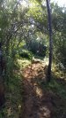
Now - as discussed on the thread with the above graphic, the site was never going to be a large part of the MTB solution, but it could make up a small part of the overall mix of cycling related activities in the area. There is scope for trials, 4X, dirt jumps, perhaps even some short freeride runs.
If you care about riding in the Northern Beaches it would be best to write in to council and ask them to vote for option 3 (dedicated MTB tracks) or a combination of options 1 and 3 (both passive recreation with MTB areas).
It might be worth pointing out a few flaws in the options arguments. Eg:
1. The option doesn't consider 4X, trails, dirt jump or freeride - it mentions "800m" of DH or XC tracks with "2.5 minute ride". Now, the area is small, but it's not that small!
2. If XC trails could be linked with the nearby areas in Garigal National Park they would be beneficial to an overall strategy for the area. Land managers have to stop thinking alone, and work together.
3. The options state number 1 (passive recreation) is, "...least likely to be affected by land fill stability.". Hardly - some might argue a bit of instability would enhance a freeride track for example.
4. The options state that number 3 (MTB trails) would have a high initial and operational cost. How so? Are there not DH, FR, DJ areas at Morgan Road, Red Hill, etc? How much do these cost council? I'm thinking the answer is, "Nothing". How then, would the tip be any different?
5. Local bike riders have always been told that Belrose Tip would be suitable and once rehabilitated form part of the solution. If this option is taken off the table - where else is council (and other local authorities) planning to accommodate the growing demand?
The bottom line is: We should be working towards a cross tenure solution for riding in the Northern Beaches and the Belrose site can be a small part of this.
Please write to council with your comments on this. Here's a handy list of addresses to copy/paste:
[email protected], [email protected], [email protected], [email protected], [email protected], [email protected], [email protected], [email protected], [email protected], [email protected]
- Login to post comments
- Bookmark & share
Evidently the inclusion of a shuttle road for DH is what has killed it:
* $350K for internal roads
* $279.4K for trail construction
If we go XC only, using the contours intelligently, the access road can be dropped at least and I reckon trail construction cost can reduced as well.
Is that they are trying to cater for the greater MTB community and not just the XC/family/lycra clad community.
Like a miniature version of stomlo with XC + DH/FR + 4X + DJ.
There is a broader community on the Northern beaches screaming out for facilities locally other than XC.
Besides, internal roads would be key to safety in the event of an accident, even on a XC circuit.
@dangersean... I think you read this incorrectly. The point to keep in mind is that they are not trying to cater for the greater MTB community. The recommendation is that they cater to people wanting to have a picnic and no-one else.
A miniature version of Stomlo with XC + DH/FR + 4X + DJ would be useful, but unless we all write in and tell council that, they will probably go with the aforementioned picnic option.
So if you want to see that, please write in people!
We don't need to go XC only to keep costs down.
For short DH runs a shuttle road isn't essential.
The area is only about 630m by 630m. About twice area of DH at OF. Perhaps enough for DJ and some FR, DH etc.
Better locations elsewhere for XC.
Let's not be splitters on this - Rob's point 2 is very valid. This site can be a key link between Cascades, Oxford Falls, Terry Hills and proposed cycle usage of the St Ives Showground / HART / Wildflower gardens area. While it may not offer much XC potential in itself, it can be a turnkey project for more extensive XC networks.
I've registered to speak to Council.
The financial analysis is flawed and will be easy to discredit.
However, we need to bear in mind these recommendations are being driven by a focus on limiting liability. WSN don't give a fetid dingo's kidney about much of anything else. We need to mitigate their concerns to get this across the line.
I'm planning on sendng a letter to Councillors sometime Monday so they've got a day or so to digest it.
Your informed input would be very helpful. My background: Certified Practising Accountant, business and financial modelling, budgeting and business analytics. Would appreciate hearing from people with information to contribute from risk management and environmental management backgrounds.
If you don't have this, don't worry - I don't have a monopoly on insight and the key idea could come from anywhere.
Email sent to the main parties encouraging some form of shared usage approach allowing the future possibility of linking into other trails. I also pointed out the obvious exaggeration in the WSN proposal that any mtb facility would require 3rd party management, liability cover and organisational capability.
Thanks for the heads up Rob
Put my 2 cents worth in and have had e mail responses already from Vincent De Luca and Virginia Laugesen (who was interested in my reference to Ku-ring-gai councils plans for the St Ives showground precinct - have sent her some links) and a phone call from Conny Harris. The latter two were very appreciative of the input - it gives them something to work with. De Luca's response was more "thanks I'll keep it in mind".
Is there really any point?
No, if there was only scope for 800m of course there would be no point. However, that estimate is completely inaccurate. As I said, the area is small, but it's not that small.
On the other hand.... even if you take that figure and try and make some sense of it, for 4X, dirt jumps or trails obstacles, 800m would be a good amount.
Why should they limit the use to picnic tables is the point, when clearly the area could make up part of the cycling facilities the area needs?
The 800 m/2.5 minute track reference is only related to downhill - that is based on some calcs I did considering slope length & gradient after inspecting the site. An XC track at the site would be of decent length however this is not mentioned in the WSN future use plan.
For information the Manly Warringah Club has been liaising with WSN & local community groups for some time regarding future MTB use of the site - think its beneficial we fill everyone in on what's been going on behind the scenes to give some context. It would also be appreciated if anyone providing submissions could email them to me ([email protected]) as we would like to keep abreast of people have put forward in case we are asked questions.
Will post again this weekend with some more info. I'll also be speaking on the night
Dave, MWMTB
Dear all,
At the council meeting on Tuesday 27th April, next Tuesday, council staff have brought forward their report and recommendations for the future use of the Belrose Landfill site.
It is quite unfortunate that council staff are recommending against option 3 (Dedicated Mountain Bike Riding tracks), despite the events earlier this year that clearly showed the need for dedicated mountain bike facilities, and despite the fact that local MPs and several councillors, including myself, have clearly stated their support for the mountain bike facility.
I would encourage all you cyclists who are interested in mountain biking to help us trying to get this amended – please send letters in support of option 3 to all councillors ([email protected],gov.au) and send letters to the editor ([email protected]).
You can also address the council meeting on the 27th April, which will be held at Narraweena Community Centre on Oceana street in Narraweena. If you’d like to address council, please contact the coordinator before 9:30 am on Tuesday. Please phone 9942 2737 or email [email protected] to register.
Regards
Christina
Hi NobMobbers,
I'm concerned but not surprised that despite unprecedented good relations in difficult circumstances and a successful meeting at Tramshed on this very subject, council management recommend to us (crs) that we ignore your patience and expertise and vote for a 37ha picnic ground with no toilets or parking that not one person has lobbied us for.
I realise the WSN isn't experienced riders' idea of a challenge, but why not have it for families, beginners and maybe some occasional variety for others, to take a bit of pressure off limited natural venues?
And please, while you're lobbying for Option 3, why not add a reminder about the lack of progress on Manly Dam volunteer days, which appears to have gone off council management's radar. Without some volunteer maintenance, "damaged" Manly Dam tracks might need to be closed down unnecessarily, ahead of their use-by date. If anyone has had correspondence to the contrary, please let me know: [email protected].
Virginia
P.S. SuperTuesday figures for northern beaches haven't been released yet. Thanks to all from this forum who got involved on the day, for Bicycle Vic.
"Your informed input would be very helpful. My background: Certified Practising Accountant, business and financial modelling, budgeting and business analytics. Would appreciate hearing from people with information to contribute from risk management and environmental management backgrounds.
If you don't have this, don't worry - I don't have a monopoly on insight and the key idea could come from anywhere."
One angle worth examining:
Young people need "stuff to do".
When the council spends a bit of money providing challenging and interesting recreational facilities for young people, there's a huge social and economic dividend for the council and community.
More recreational facilities = far less of a problem with graffiti (which council has to fix) and fewer young drunken males rampaging through the corso every saturday night (vandalism, litter, general mess council currently deals with).
As many probably know the WSN facility has been spoken about as a potential MTB venue for many years, and MWMTB has been playing the lobbying game for the site for equally as long. Initially the venue was scheduled for closure last year, however, following the State government's review of their waste strategy the landfill license was extended until 2014. It is worth noting that the landfill is very close to capacity and may close earlier once the final permissible filling levels have been reached. The areas of the site most suitable for MTB tracks are the northern and western slopes - these areas are away from the current active cells and have predominantly been rehabilitated. We have explored the potential for tracks to be developed in this area whilst the landfill is still active, being used on weekends only when most of the site is closed. Initially things looked promising however, WSN have now basically canned any support for this citing liabilities as the main factor.
As part of the landfill license, WSN are required to rehabilitate the site after filling has ceased and it has been agreed that the land would be used for recreational purposes. All landfills will subside for many years after closure and for this reason future use options are limited. For example, built structures of any kind would be a problem and even sporting ovals would not be feasible due to differential settlement. Really, the only things the site is good for is a few tracks for walking, bikes and horses. There is strong support for future MTB use from the local community associations and local state members Jonathon O'Dea and Mike Baird. To be honest, we thought things were progressing well until we got wind of the meeting on Tuesday. It is also interesting that we were not advised of it & only found out via a couple of Warringah Councilors.....
As part of the rehabilitation strategy WSN has been required to progressively set aside $ in an enhancement fund to contribute towards the future use of the site - at closure there is expected to be ~ $3.5 million in the fund. Also, it has been a requirement that WSN prepare a future use plan to evaluate the potential recreational reuse of the site post closure. WSN really doesn't care what the final use of the site is and how the enhancement fund gets spent - their main concern is liability first and foremost.
The future use plan is the document that Warringah Council is using as the basis for their recommendation, and this is the problem. The cost estimates that WSN has outlined are preliminary guestimates based on limited info and general concepts only, and at the very least need refinement based on expert advice before a final decision is made. I actually know someone at Warringah Council who was instrumental in recommending Option 1 - picnic areas, dog walking etc & discussing with them the other night Council is primarily concerned about having to allocate $ to site upkeep after the enhancement fund is spent.
There will be challenges with the future recreational use of the site whatever it may be. The land will be subject to subsidence for a number of years, there will still be outgassing from methane wells and it is critical that the clay cap is not breached. That means that any MTB tracks will need to be constructed on top of the final land surface using imported soil to ensure the minimal cap thickness is maintained - yes, trail construction costs would be high, however, WSN is required to import thousands of metres cubed of soil to complete the capping and bringing in an extra amount & stockpiling on-site for track construction would be a cost effective solution. And if the trails were constructed properly first time the annual maintenace costs would be minimised - in my opinion the estimated annual maintenance costs are a gross over estimate and this should form a large part of our arguement. Also, another point we need to convince Council of is that simply converting the site to public parkland is likely to fail. Keep in mind that trees can't be grown on the site as they will breach the cap and the site is very exposed. That means no shade and no shelter. Also, its a landfill for christ sake so its hardly aesthetically pleasing, especially given the methane outgassing that will occur. For these reasons Option 1 is likely to result in the site being under-utilised and is therefore not a cost effective may of spending the money. Giving it to a dedicated user group who would activly contribute to upkeep would be a far better option.
With regard to the nature of proposed future MTB use, the ideal outcome would be a series of xc trails, couple of downhill/freeride trails and maybe a pumptrack or small skills track that kids could use etc. The site would also serve as a race track for the club. The costs that have been attributed to access road construction are not related to a shuttle road for DH - any DH trails would ideally finish near the methane plant at the bottom of the site which already has an asphalt road leading back up to site entrance. WSN have apparently assumed a sealed road would be needed to a main trailhead area. In fact, given the final contour of the land a road and carpark would probably also be needed for Option 1 to provide ready access to the main flat part and high point of the site, which is a bit of a hike in from the main entrance.
Hope to see a few of you tomorrow night...
Dave
MWMTB
Not very coherent I'm afraid, but beter than nothing:
Dear Councillors
I would like to take this opportunity to write to you regarding the Belrose Waste and Recycling Centre – Draft Future Use Concept Plan.
As a local resident and keen mountain biker, I would like to register my strong support for Option 3 ( or a variation thereof).
While the area in question is not extensive, it could undoubtedly serve a significant part in a coherent mtb strategy in the area. The area in question could serve XC mountain biking needs when combined with currently well used fire trails in Garigal NP ( and with a little cooperation and forethought, could be linked with other trails all the way to Manly Dam ).
It would also appear to be an area which would lend itself well to the types of mountain biking which have even less facilities than XC: dirt jumps, trials and 4X ( it should be noted that the current men's and women's 4X World Champions are both young Australians....) These disciplines are highly popular with the younger members of the mountain biking community and providing facilities for them would be a wonderful opportunity to help promote healthy lifestyle choices among the Xbox generation.
The report seems to be suggesting that there is significant cost in the provision of on site supervision for a mountain bike facility. This supposed need would run contrary to the experience of most mountain bikers. In 23 years of mountain biking, I have never ridden anywhere with on site supervision. The facility could be built ( largely using volunteer labour) and then periodically maintained as required ( again by volunteer labour) It doesn’t need anything else.... The topography of the site also means that tracks would be accessible ( including a DH track with ‘shuttle capability) without the need for a new road. As such, I feel the costs related to Option 3 are significantly overstated.
Concern has been raised about the possible instability of the ground conditions at the site. I would suggest that this presents less of an obstruction to mountain bikers than most other groups. To also suggest that there are concerns that riders might be put of by residual smells and then proposing to install picnic tables instead is difficult to understand.
I am somewhat surprised and very disappointed that the current recommendation from council management is to provide a facility which no one appears to have asked for and which I believe hardly anyone will use. If Option 1 is supported, the only winner will be WSN.
As with the recent Manly dam fiasco, it appears that strategic decisions are determined not by our elected councillors but by bureaucrats who’s main interest seems to be limiting liability rather than providing meaningful services to the local community.
Yours respectfully
Craig Burns
Address provided
I'll try to make it to the meeting but can't promise anything....
CB
I just sent this, and got a couple of replies stating support for this view within minutes. Just drop them a line in the same vein, you don't have to write an essay
Thanks for your input guys. Here's what I sent.
I have had a response from one of the councillors, Michelle Ray, saying that option 3 was voted the winner on the night. I will take that as a positive but lets see what the outcome is....